quadkeyr: Projecting Human Mobility and Disease Data to Support Decision-Making
quadkeyr is an R package for analyzing human mobility data. It supports reproducible spatial analysis of Facebook (Meta) Mobility data and is used across research workflows, an interactive dashboard, and a pandemic scrollytelling case study

This project is part of the Eco-epidemiology of Zoonotic Diseases Lab at the Paul Allen School of Global Health, Washington State University. You can learn more about the project in the following slides.
This project, which I will describe in a technical manner, consisted of several distinct components:
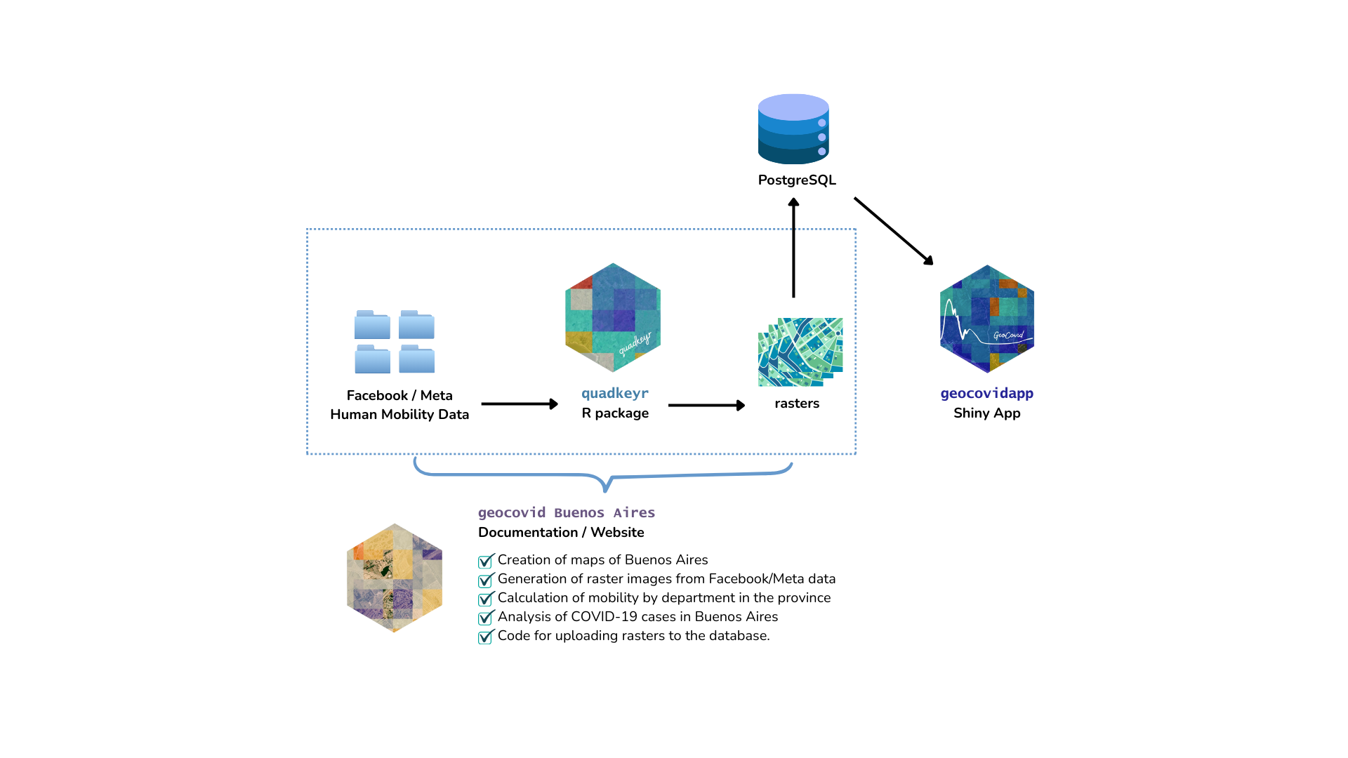
quadkeyrR package: an R package that allows the conversion of human mobility data into raster images. The package has been approved through the rOpenSci peer-review process, and both its documentation and a published article are available.GeoCOVID Buenos Aires: a website built with Quarto to host selected project-specific analyses.
GeocovidApp: a dashboard developed with golem and R to explore human mobility patterns during the COVID-19 pandemic in Buenos Aires, Argentina.
Mobility Matters: an interactive storytelling project that presents and contextualizes the findings from a narrative perspective.
A manuscript synthesizing the results of this work is currently under preparation.
Image generated by Gemini (Google AI) based on human mobility concepts and quadkey spatial analysis.